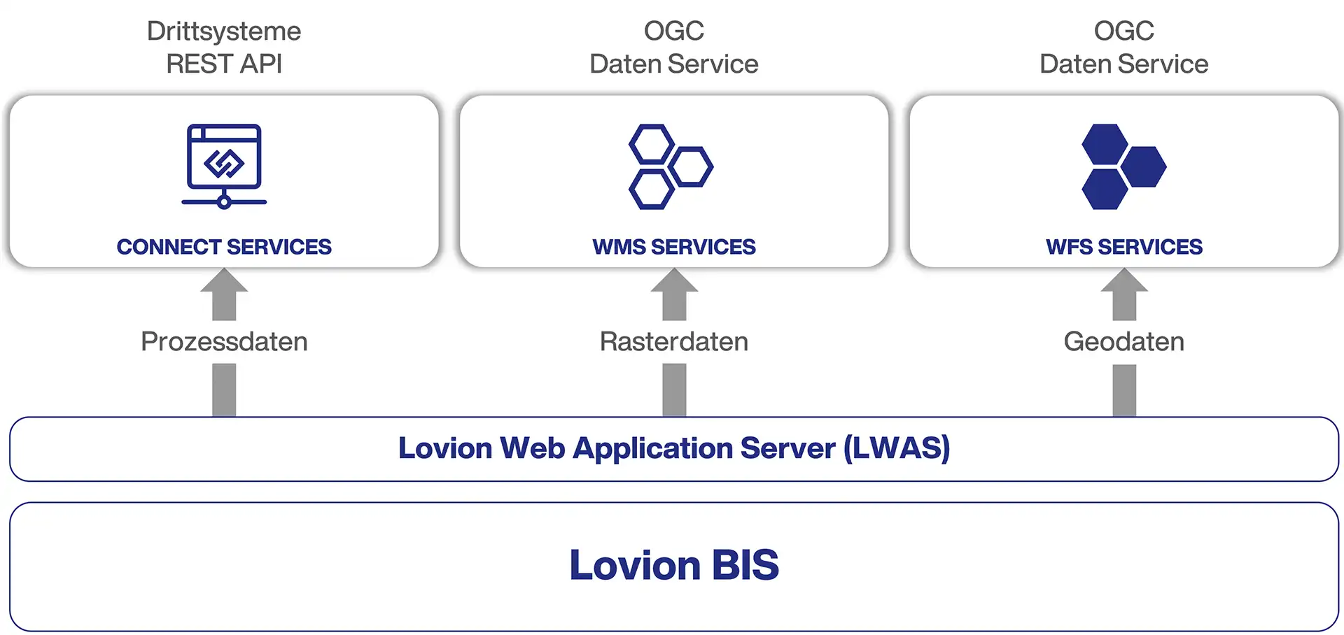
Integrating Web Services
Lovion CONNECT SERVICES provides a platform for integrating Lovion with third-party systems through web services. These are made available using RESTful web services. Provided data by Lovion CONNECT SERVICES is serialised in the JSON format. The server implements HTTP/2 with TCP/IP (v4 or v6) as a safety transport protocol. This is especially important for the safety when transferring data via the intranet or internet.
The Lovion WMS (Web Map Server) makes layer-based maps in Lovion available to other systems via the internet. These maps are made available in a raster format. Depending on the WMS specifications, the Lovion WMS also provides metadata required to correctly map the data, such as the available layers and coordinate systems. As an extension of WMS, Lovion also offers tools to provide and manage map tiles, also known as Web Map Tile Service (WMTS).
Lovion WFS (Web Feature Service) provides access to data within a Lovion project via the intranet or internet. Lovion WFS only supports vector and attribute data and does not provide any tiled maps. However, regular attribute and geographic queries are possible. These query results are made available to external systems as a GML (Geographic Mark-up Language) and are based on the WFS specifications in Lovion.
© 2024 Lovion GmbH. All rights reserved.
Leider ist unsere Website nicht für den Internet Explorer konzipiert. Für eine optimale Darstellung empfehlen wir Ihnen einen aktuellen Browser zu verwenden!