Integrating different Data Formats
Vector data in a DXF or DWG file format can be imported into Lovion using the module Lovion DXF CONNECT. DXF files can be made visible as separate layers in Lovion. Furthermore, it is also possible to export drawings in an DXF or DWG file format.
Shapefiles are a widely used standard for vector data. Geometries including their attribute data can be imported into Lovion using Lovion SHAPE CONNECT. Furthermore, it is also possible to transform geographic coordinates into project coordinates.
GeoJSON is an open-source data format based on JavaScript Object Notation (JSON) which is used for geographic data. GeoJSON data can be imported into Lovion using the GeoJSON connector. In addition, it is also possible to transform geographic coordinates into project coordinates.
Data from CSV files can be imported into Lovion using the CSV connector. CSV files are text files where numerous values appear in one line, separated by a unique character or a space. It is possible to import alphanumeric as well as geometric data, for example using the WKT format.
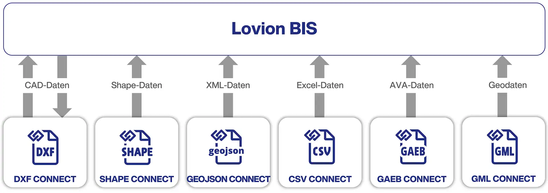
The module Lovion GAEB CONNECT enables calculation data based on a plan created in Lovion to be transmitted to established AVA programmes, such as California, ARRIBA Sysbau. The data transmission into AVA programmes is done in the GAEB file format. Currently, (DA) X31 and X52 formats are supported, whereas further data formats are supported in project-specific solutions. After exporting the data to the AVA programme, the derived costs can be transferred back to Lovion.
GML, the Geography Markup Language is an open-source XML format for geographic data. By implementing Lovion GML CONNECT, GML data can be imported into Lovion. Furthermore, it is also possible to transform geographic coordinates into project coordinates.
© 2024 Lovion GmbH. All rights reserved.
Leider ist unsere Website nicht für den Internet Explorer konzipiert. Für eine optimale Darstellung empfehlen wir Ihnen einen aktuellen Browser zu verwenden!